
Forests are hard to describe. So much complexity, so much thriving life. Colours, light and forms change with the seasons, and over time. How to fit all that into words or pictures?
The ways to describe a forest are infinite, and each approach will also be influenced by the person making the observations and creating the description. I’m an ecologist, and I work mostly in Australia. So in this article I’m exploring a way to describe our Australian forests (and other vegetation types such as woodlands, shrublands and grasslands), in a nature journal, by using elements of forest structure and life forms, the way ecologists do.
Because this approach emphasizes structural traits (e.g. tree height, canopy cover) and life forms (tree, shrub, grass), you don’t need to identify every plant to come up with a description of the vegetation type. Once you know the vegetation type, this opens the door to learning more about its ecology, including what kinds of animals and plants might live there.
This approach can also be used in a comparative way, e.g. by comparing different places you might visit on a road trip, or even the same place in different seasons, over time, or after a disturbance (e.g. fire, cyclone, grazing).
How it works
- First, go to the place you want to describe. This method works best for places in Australia that still have fairly intact native vegetation.
Describe the height of the tallest life forms
- What are the tallest life forms (e.g. trees, shrubs, grasses)?
- Draw a large rectangle on your page. This will be used to describe the height of the tallest life form.
Tip: If the tallest life forms are trees, and the trees are a lot taller than they are wide, draw the large rectangle in portrait orientation.

If the tallest life forms are trees, and the trees are wider than they are tall, draw the large rectangle in landscape orientation. Landscape orientation is also better for describing vegetation types with no trees, e.g. shrublands or grasslands.

- Estimate the height of the tallest life form. The easiest way to do this is to get a person to stand next to it, and estimate how many of that person, standing on each others’ heads, would make up the height of the tallest life form. So if the person is 2 metres high, and approximately 10 of that person fit into the height of the tallest life form, then that tallest life form is about 20 metres high. If you’re doing this by yourself, just imagine a 2-metre-tall person standing at the base of the tree.
- In the large rectangle, draw the tallest life form in profile (side) view. Draw a scale bar on the side and mark the height of the tallest life form. I also like to draw a stick-figure human in the rectangle to give a more pictorial measure of scale.
- The large rectangle is mostly about describing height of the tallest life forms, but as you can see from my example above, you can also record quite a lot about plant shape, density and arrangement, and also the colours, light and other aspects of the place.
Describe the canopy cover
For this activity, the canopy is the leaf/branch/trunk part of the tallest life forms. You need to estimate what percentage of the sky is shaded by this leaf/branch/trunk part. This can be tricky, and you might get a sore neck looking up and trying to do it. But canopy cover has many important implications for the ecology of a place, so that’s why it’s important to be aware of it. Try to estimate which category the canopy cover of your place fits into, using the options below.
The leaf/branch/trunk part of the tallest life forms covers:
- Less than 10 percent of the sky
- 10 – 30 % of the sky
- 30 – 70 % of the sky
- 70 – 100 % of the sky
If you want to represent this visually, draw a square on the same page as the large rectangle. Look up, and sketch a portion of what you see in this square. You can also take a photo of the canopy, and draw in the square using the photo as reference.

Describe what’s on the ground
Draw another square on your page and look down at your feet. Draw what’s on the ground, from a bird’s eye view.

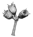
Describe leaves, flowers, fruits and any other interesting life forms.
This is optional, but it can really add flavour to your description of a place.

Determine the structural formation of the vegetation
Use the height of the tallest life form and the canopy cover to work out the structural formation of the vegetation you’re describing, using the table below. (Note that ‘canopy cover’ is equivalent to ‘Foliage projective cover of the tallest stratum’ in the table below).
So for my example above:
- Tallest life form = trees
- Height = 40 m
- Canopy cover = 30 – 70 % of the sky
- Structural formation = Tall open-forest (Also known as Wet Sclerophyll Forest)

(Note that a tree is defined as a woody plant usually with a single stem; a shrub is a woody plant with many stems arising at or near the base.)
The above table is adapted from Keith (2017) Australian Vegetation, Cambridge University Press, Cambridge; based on Specht, R.L. (1970) Vegetation. In ‘The Australian Environment’, 4th edn. CSIRO Australia and Melbourne University Press, Melbourne. (If you’re after a detailed and up-to-date account of the ecology of Australian vegetation types, Keith (2017) Australian Vegetation is the book to read.)
Here’s another example, describing the forest along the Border Track, Lamington National Park, about 150 m from the trailhead at Binna Burra, Qld:

The structural type of this forest is ‘Closed forest’. It’s also known as subtropical rainforest. Here’s some extra flavours of the forest:


Also add as many notes and written observations as you like.
Why drawings and not photos? I encourage you to draw these things because the act of drawing forces you to slow down and look closely.
Why enclose the drawings in rectangles and squares? I find that if I give myself a small, limited area for drawing, this encourages me to make my drawings simpler, but it also forces me to to zero in on the most important features.
I am still experimenting with this approach to ‘describing a place’ and would love to hear your feedback. Maybe you could even give it a test drive and let me know what you think?
Happy nature journaling!
Discover more from Paperbark Writer
Subscribe to get the latest posts sent to your email.
This is brilliant Paula! I’ve been looking for different ways to describe habitats. I love your approach. To my eyes, it is new and exciting in the possibilities it opens. Will definitely try it out in local places.
Thanks Cati! I’ll be interested to hear how you go 🙂
Great and informative post thank you.
Thanks Sue!
I absolutely love this post! Thank you!
Thanks Brenda!
I love this. Thank you for describing your approach so clearly!
Thanks Jo!
I love the way that you open my eyes to what I am seeing. That you a leading me to attempt to capture it through drawing than through the lens!
Great to hear! Thanks Kathy 🙂
Thanks Paula. A great way to intensify focus when in a large natural environment. I love the way drawing helps me to see more.
Thanks Janet. Yes I like your description of ‘intensifying focus’. Sometimes I find there is so much going on it’s easy to not see the wood for the trees 🙂 Happy nature journaling!
Hi Paula, Thanks for this, I always wanted to be a real ecologist!
Cheers, Joan
Thanks Joan!
Thanks so much Paula. This has been very informative, I really needed this for my book.
Hi Bobby, I’m glad it was useful for you. What sort of book are you working on? Cheers, Paula